This page presents a variety of calculations for latitude/longitude points, with the formulas and
code fragments for implementing them.
All these formulas are for calculations on the basis of a spherical earth (ignoring ellipsoidal
effects) – which is accurate enough* for
most purposes… [In fact, the earth is very slightly ellipsoidal; using a spherical model gives
errors typically up to 0.3%1
– see notes for further details].
Distance
This uses the ‘haversine’ formula to calculate the great-circle distance between two
points – that is, the shortest distance over the earth’s surface – giving an ‘as-the-crow-flies’
distance between the points (ignoring any hills they fly over, of course!).
Haversine formula:
a = sin²(Δφ/2) + cos φ1 ⋅ cos φ2 ⋅ sin²(Δλ/2)
c = 2 ⋅ atan2( √a, √(1−a) )
d = R ⋅ c
where:
φ is latitude, λ is longitude, R is earth’s radius (mean radius = 6,371km);
note that angles need to be in radians to pass to trig functions!
JavaScript:
const R =6371e3;// metresconstφ1= lat1 *Math.PI/180;// φ, λ in radiansconstφ2= lat2 *Math.PI/180;constΔφ=(lat2-lat1)*Math.PI/180;constΔλ=(lon2-lon1)*Math.PI/180;const a =Math.sin(Δφ/2)*Math.sin(Δφ/2)+Math.cos(φ1)*Math.cos(φ2)*Math.sin(Δλ/2)*Math.sin(Δλ/2);const c =2*Math.atan2(Math.sqrt(a),Math.sqrt(1-a));const d = R * c;// in metres
Note in these scripts, I generally use lat/lon for latitude/longitude in degrees, and φ/λ for
latitude/longitude in radians – having found that mixing degrees & radians is often the
easiest route to head-scratching bugs...
The haversine
formula1 ‘remains
particularly well-conditioned for numerical computation even at small distances’ – unlike
calculations based on the spherical law
of cosines. The ‘(re)versed sine’ is 1−cosθ, and the
‘half-versed-sine’ is (1−cosθ)/2 or sin²(θ/2) as used above.
Once widely used by navigators, it was described by Roger Sinnott in
Sky & Telescope
magazine in 1984 (“Virtues of the Haversine”): Sinnott explained that the angular separation
between Mizar and Alcor in Ursa Major – 0°11′49.69″ – could be accurately calculated in Basic on a
TRS-80 using the haversine.
For the curious, c is the angular distance in radians, and a is the square of half
the chord length between the points.
If atan2 is not available, c could be calculated
from 2 ⋅ asin( min(1, √a) )
(including protection against rounding errors).
Using Chrome on an aging Core i5 PC, a distance calculation takes around
2 – 5 microseconds (hence around 200,000 – 500,000 per second).
Little to no benefit is obtained by factoring out common terms; probably the JIT compiler
optimises them out.
Spherical Law of Cosines
In fact, JavaScript (and most modern computers & languages) use ‘IEEE 754’ 64-bit floating-point
numbers, which provide 15 significant figures of precision. By my estimate, with this precision,
the simple spherical law of
cosines formula (cos c = cos a cos b + sin a sin b cos C)
gives well-conditioned results down to distances as small as a few metres on the earth’s surface.
(Note that the geodetic form of the law of cosines is rearranged from the
canonical one so that the latitude can be used directly, rather than the
colatitude).
This makes the simpler law of cosines a reasonable 1-line alternative to the haversine formula for
many geodesy purposes (if not for astronomy). The choice may be driven by programming language, processor,
coding context, available trig functions (in different languages), etc – and, for very small distances an
equirectangular approximation may be more suitable.
Law of cosines:
d = acos( sin φ1 ⋅ sin φ2 + cos φ1 ⋅ cos φ2 ⋅ cos Δλ ) ⋅ R
JavaScript:
constφ1= lat1 *Math.PI/180,φ2= lat2 *Math.PI/180,Δλ=(lon2-lon1)*Math.PI/180, R =6371e3;const d =Math.acos(Math.sin(φ1)*Math.sin(φ2)+Math.cos(φ1)*Math.cos(φ2)*Math.cos(Δλ))* R;
const x =(λ2-λ1)*Math.cos((φ1+φ2)/2);const y =(φ2-φ1);const d =Math.sqrt(x*x + y*y)* R;
This uses just one trig and one sqrt function – as against half-a-dozen trig functions for cos
law, and 7 trigs + 2 sqrts for haversine. Accuracy is somewhat complex: along meridians there
are no errors, otherwise they depend on distance, bearing, and latitude, but are small enough
for many purposes* (and often trivial compared
with the spherical approximation itself).
Alternatively, the polar coordinate flat-earth formula can be used:
using the co-latitudes θ1 = π/2−φ1 and θ2 = π/2−φ2,
then d = R ⋅ √θ1² + θ2² − 2 ⋅ θ1 ⋅ θ2 ⋅ cos Δλ.
I’ve not compared accuracy.
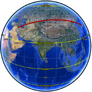
Baghdad to Osaka –
not a constant bearing!
Bearing
In general, your current heading will vary as you follow a great circle path (orthodrome); the
final heading will differ from the initial heading by varying degrees according to distance and
latitude (if you were to go from say 35°N,45°E (≈ Baghdad) to 35°N,135°E (≈ Osaka), you
would start on a heading of 60° and end up on a heading of 120°!).
This formula is for the initial bearing (sometimes referred to as forward azimuth) which if
followed in a straight line along a great-circle arc will take you from the start point to the
end point:1
Formula:
θ = atan2( sin Δλ ⋅ cos φ2 , cos φ1 ⋅ sin φ2 − sin φ1 ⋅ cos φ2 ⋅ cos Δλ )
where:
φ1,λ1 is the start point,
φ2,λ2 the end point (Δλ is the difference in longitude)
JavaScript:
(all angles in radians)
const y =Math.sin(λ2-λ1)*Math.cos(φ2);const x =Math.cos(φ1)*Math.sin(φ2)-Math.sin(φ1)*Math.cos(φ2)*Math.cos(λ2-λ1);constθ=Math.atan2(y, x);const brng =(θ*180/Math.PI +360)%360;// in degrees
Excel:
(all angles in radians)
=ATAN2(COS(lat1)*SIN(lat2)-SIN(lat1)*COS(lat2)*COS(lon2-lon1),
SIN(lon2-lon1)*COS(lat2))
*note that Excel reverses the arguments to ATAN2 – see notes below
Since atan2 returns values in the range -π ... +π (that is, -180° ... +180°), to
normalise the result to a compass bearing (in the range 0° ... 360°, with −ve values transformed
into the range 180° ... 360°), convert to degrees and then use (θ+360) % 360, where %
is (floating point) modulo.
For final bearing, simply take the initial bearing from the end point
to the start point and reverse it (using θ = (θ+180) % 360).
Midpoint
This is the half-way point along a great circle path between the two
points.1
Formula:
Bx = cos φ2 ⋅ cos Δλ
By = cos φ2 ⋅ sin Δλ
φm = atan2( sin φ1 + sin φ2,
√(cos φ1 + Bx)² + By² )
The longitude can be normalised to −180…+180 using (lon+540)%360-180
Just as the initial bearing may vary from the final bearing, the midpoint may
not be located half-way between latitudes/longitudes; the midpoint between 35°N,45°E
and 35°N,135°E is around 45°N,90°E.
Intermediate point
An intermediate point at any fraction along the great circle path between two points can also be
calculated.1
Formula:
a = sin((1−f)⋅δ) / sin δ
b = sin(f⋅δ) / sin δ
x = a ⋅ cos φ1 ⋅ cos λ1 + b ⋅ cos φ2 ⋅ cos λ2
y = a ⋅ cos φ1 ⋅ sin λ1 + b ⋅ cos φ2 ⋅ sin λ2
z = a ⋅ sin φ1 + b ⋅ sin φ2
φi = atan2(z, √x² + y²)
λi = atan2(y, x)
where:
f is fraction along great circle route (f=0 is point 1, f=1 is point 2), δ is the angular
distance d/R between the two points.
Destination point given distance and bearing from start point
Given a start point, initial bearing, and distance, this will calculate the destination point and
final bearing travelling along a (shortest distance) great circle arc.
Formula:
φ2 = asin( sin φ1 ⋅ cos δ + cos φ1 ⋅ sin δ ⋅ cos θ )
λ2 = λ1 + atan2( sin θ ⋅ sin δ ⋅ cos φ1, cos δ − sin φ1 ⋅ sin φ2 )
where:
φ is latitude, λ is longitude, θ is the bearing (clockwise from north),
δ is the angular distance d/R; d being the distance travelled, R the earth’s radius
The longitude can be normalised to −180…+180 using (lon+540)%360-180
Excel:
(all angles in radians)
lat2: =ASIN(SIN(lat1)*COS(d/R) + COS(lat1)*SIN(d/R)*COS(brng))
lon2: =lon1 + ATAN2(COS(d/R)-SIN(lat1)*SIN(lat2), SIN(brng)*SIN(d/R)*COS(lat1))
* Remember that Excel reverses the arguments to ATAN2 – see notes below
For final bearing, simply take the initial bearing from the end point to the start
point and reverse it with (brng+180)%360.
Intersection of two paths given start points and bearings
This is a rather more complex calculation than most others on this page, but I've been asked for it a number of times.
This comes from Ed William’s aviation formulary.
See below for the JavaScript.
Formula:
δ12 = 2⋅asin( √(sin²(Δφ/2) + cos φ1 ⋅ cos φ2 ⋅ sin²(Δλ/2)) )
angular dist. p1–p2
θa = acos( ( sin φ2 − sin φ1 ⋅ cos δ12 ) / ( sin δ12 ⋅ cos φ1 ) )
θb = acos( ( sin φ1 − sin φ2 ⋅ cos δ12 ) / ( sin δ12 ⋅ cos φ2 ) )
α3 = acos( −cos α1 ⋅ cos α2 + sin α1 ⋅ sin α2 ⋅ cos δ12 )
angle p1–p2–p3
δ13 = atan2( sin δ12 ⋅ sin α1 ⋅ sin α2 , cos α2 + cos α1 ⋅ cos α3 )
angular dist. p1–p3
φ3 = asin( sin φ1 ⋅ cos δ13 + cos φ1 ⋅ sin δ13 ⋅ cos θ13 )
p3 lat
Δλ13 = atan2( sin θ13 ⋅ sin δ13 ⋅ cos φ1 , cos δ13 − sin φ1 ⋅ sin φ3 )
long p1–p3
λ3 = λ1 + Δλ13
p3 long
where
φ1, λ1, θ13 : 1st start point & (initial) bearing from 1st point towards intersection point
φ2, λ2, θ23 : 2nd start point & (initial) bearing from 2nd point towards intersection point
φ3, λ3 : intersection point
% = (floating point) modulo
note –
if sin α1 = 0 and sin α2 = 0: infinite solutions
if sin α1 ⋅ sin α2 < 0: ambiguous solution
this formulation is not always well-conditioned for meridional or equatorial lines
This is a lot simpler using vectors rather than spherical trigonometry:
see latlong-vectors.html.
Cross-track distance
Here’s a new one: I’ve sometimes been asked about distance of a point from a great-circle path
(sometimes called cross track error).
Formula:
dxt = asin( sin(δ13) ⋅ sin(θ13−θ12) ) ⋅ R
where
δ13 is (angular) distance from start point to third point
θ13 is (initial) bearing from start point to third point
θ12 is (initial) bearing from start point to end point
R is the earth’s radius
Here, the great-circle path is identified by a start point and an end point – depending on what initial data you’re working from,
you can use the formulas above to obtain the relevant distance and bearings.
The sign of dxt tells you which side of the path the third point is on.
The along-track distance, from the start point to the closest point on the path to the third point, is
Formula:
dat = acos( cos(δ13) / cos(δxt) ) ⋅ R
where
δ13 is (angular) distance from start point to third point
δxt is (angular) cross-track distance
R is the earth’s radius
JavaScript:
constδ13= d13 / R;const dAt =Math.acos(Math.cos(δ13)/Math.cos(dXt/R))* R;
Closest point to the poles
And: ‘Clairaut’s formula’ will give you the maximum latitude of a great circle path,
given a bearing θ and latitude φ on the great circle:
A ‘rhumb line’ (or loxodrome) is a path of constant bearing, which crosses all meridians at the
same angle.
Sailors used to (and sometimes still) navigate along rhumb lines since it is easier to follow
a constant compass bearing than to be continually adjusting the bearing, as is needed to follow
a great circle. Rhumb lines are straight lines on a Mercator Projection map (also helpful for
navigation).
Rhumb lines are generally longer than great-circle (orthodrome) routes. For instance, London to New
York is 4% longer along a rhumb line than along a great circle – important for aviation fuel,
but not particularly to sailing vessels. New York to Beijing – close to the most extreme example
possible (though not sailable!) – is 30% longer along a rhumb line.
Key to calculations of rhumb lines is the inverse Gudermannian function¹, which gives the ‘isometric latitude’ (ψ), equivalent to the height on a Mercator projection map of a given geodetic latitude – this can be expessed in various ways:
ψ = ln( tan(π/4 + φ/2) )
ψ = ln( tanφ + secφ ) [i.e. ln( tanφ + 1/cosφ )]
ψ = asinh( tanφ ) [≡ atanh( sinφ )]
The isometric latitude of course tends to infinity at the poles (in keeping with the Mercator projection).
For obsessives, this is a simplification of the full ellipsoidal version:
The formulas to derive Mercator projection easting and northing coordinates from spherical latitude and longitude are then:
E = R ⋅ λ
N = R ⋅ ln( tan(π/4 + φ/2) )
The following formulas are from Ed Williams’ aviation formulary¹.
Distance
Since a rhumb line is a straight line on a Mercator projection, the distance between two points
along a rhumb line is the length of that line (by Pythagoras); but the distortion of the
projection needs to be compensated for.
On a constant latitude course (travelling east-west), this compensation is simply
cosφ; in the general case, it is Δφ/Δψ
where Δψ is the ‘isometric’ (projected) latitude difference.
Formula:
Δψ = ln( tan(π/4 + φ2/2) / tan(π/4 + φ1/2) )
q = Δφ / Δψ (or cosφ for E-W line)
d = √(Δφ² + q²⋅Δλ²) ⋅ R
(Pythagoras)
where:
φ is geodetic latitude, ψ is isometric latitude, λ is longitude,
Δλ is taking shortest route (<180°),
R is the earth’s radius, ln is natural log
JavaScript:
(all angles in radians)
constΔψ=Math.log(Math.tan(Math.PI/4+φ2/2)/Math.tan(Math.PI/4+φ1/2));const q =Number.isFinite(Δφ/Δψ)?Δφ/Δψ:Math.cos(φ1);// E-W course becomes ill-conditioned with 0/0// if dLon over 180° take shorter rhumb line across the anti-meridian:if(Math.abs(Δλ)>Math.PI)Δλ=Δλ>0?-(2*Math.PI-Δλ):(2*Math.PI+Δλ);const dist =Math.sqrt(Δφ*Δφ+ q*q*Δλ*Δλ)* R;
Bearing
A rhumb line is a straight line on a Mercator projection, with an angle on the projection equal
to the compass bearing.
Formula:
Δψ = ln( tan(π/4 + φ2/2) / tan(π/4 + φ1/2) )
θ = atan2(Δλ, Δψ)
where:
φ is geodetic latitude, ψ is isometric latitude, λ is longitude, Δλ is taking shortest route (<180°), R is the earth’s radius, ln is natural log
JavaScript:
(all angles in radians)
constΔψ=Math.log(Math.tan(Math.PI/4+φ2/2)/Math.tan(Math.PI/4+φ1/2));// if dLon over 180° take shorter rhumb line across the anti-meridian:if(Math.abs(Δλ)>Math.PI)Δλ=Δλ>0?-(2*Math.PI-Δλ):(2*Math.PI+Δλ);const brng =Math.atan2(Δλ,Δψ)*180/Math.PI;
Destination
Given a start point and a distance d along constant bearing θ, this will calculate
the destination point. If you maintain a constant bearing along a rhumb line, you will gradually
spiral in towards one of the poles.
Formula:
φ2 = φ1 + δ ⋅ cos θ
Δψ = ln( tan(π/4 + φ2/2) / tan(π/4 + φ1/2) )
q = Δφ / Δψ (or cos φ for E-W line)
Δλ = δ ⋅ sin θ / q
λ2 = λ1 + Δλ
where:
δ is angular distance, φ is geodetic latitude, ψ is isometric latitude, λ is longitude, Δλ is taking shortest route
(<180°), ln is natural log, R is the earth’s radius
JavaScript:
(all angles in radians)
constδ= d/R;constΔφ=δ*Math.cos(θ);constφ2=φ1+Δφ;constΔψ=Math.log(Math.tan(φ2/2+Math.PI/4)/Math.tan(φ1/2+Math.PI/4));const q =Math.abs(Δψ)>10e-12?Δφ/Δψ:Math.cos(φ1);// E-W course becomes ill-conditioned with 0/0constΔλ=δ*Math.sin(θ)/q;constλ2=λ1+Δλ;// check for some daft bugger going past the pole, normalise latitude if soif(Math.abs(φ2)>Math.PI/2)φ2=φ2>0?Math.PI-φ2:-Math.PI-φ2;
The longitude can be normalised to −180…+180 using (lon+540)%360-180
Mid-point
This formula for calculating the ‘loxodromic midpoint’, the point half-way along a rhumb line
between two points, is due to Robert Hill and Clive
Tooth1 (thx
Axel!).
if(Math.abs(λ2-λ1)>Math.PI)λ1+=2*Math.PI;// crossing anti-meridianconstφ3=(φ1+φ2)/2;const f1 =Math.tan(Math.PI/4+φ1/2);const f2 =Math.tan(Math.PI/4+φ2/2);const f3 =Math.tan(Math.PI/4+φ3/2);constλ3=((λ2-λ1)*Math.log(f3)+λ1*Math.log(f2)-λ2*Math.log(f1))/Math.log(f2/f1);if(!isFinite(λ3))λ3=(λ1+λ2)/2;// parallel of latitude
The longitude can be normalised to −180…+180 using (lon+540)%360-180
Using the scripts in web pages
Using these scripts in web pages would be something like the following:
<!doctype html><htmllang="en"><head><title>Using the scripts in web pages</title><metacharset="utf-8"><scripttype="module">importLatLon from 'https://cdn.jsdelivr.net/npm/geodesy@2/latlon-spherical.min.js';
document.addEventListener('DOMContentLoaded',function(){
document.querySelector('#calc-dist').onclick =function(){
calculateDistance();}});function calculateDistance(){const p1 =LatLon.parse(document.querySelector('#point1').value);const p2 =LatLon.parse(document.querySelector('#point2').value);const dist = parseFloat(p1.distanceTo(p2).toPrecision(4));
document.querySelector('#result-distance').textContent = dist +' metres';}</script></head><body><form>
Point 1: <inputtype="text"name="point1"id="point1"placeholder="lat1,lon1">
Point 2: <inputtype="text"name="point2"id="point2"placeholder="lat2,lon2"><buttontype="button"id="calc-dist">Calculate distance</button><outputid="result-distance"></output></form></body></html>
Convert between degrees-minutes-seconds & decimal degrees
Notes:
Accuracy: since the earth is not quite a sphere, there are small errors in
using spherical geometry; the earth is actually roughly ellipsoidal (or more precisely,
oblate spheroidal) with a radius varying between about 6,378km (equatorial) and 6,357km (polar),
and local radius of curvature varying from 6,336km (equatorial meridian) to 6,399km (polar).
6,371 km is the generally accepted value for the earth’s
mean radius. This means that errors
from assuming spherical geometry might be up to 0.55% crossing the equator, though generally
below 0.3%, depending on latitude and direction of travel (whuber explores this in excellent
detail on stackexchange).
An accuracy of better than 3m in 1km is mostly good enough for me, but if you want greater
accuracy, you could use the Vincenty formula for
calculating geodesic distances on ellipsoids, which gives results accurate to within 1mm.
(Out of sheer perversity – I’ve never needed such accuracy – I looked up this formula and
discovered the JavaScript implementation was simpler than I expected).
Trig functions take arguments in radians, so latitude, longitude, and bearings in
degrees (either decimal or degrees/minutes/seconds) need to be converted to radians,
rad = deg⋅π/180. When converting radians back to degrees (deg = rad⋅180/π), West is negative
if using signed decimal degrees. For bearings, values in the range -π to +π [-180° to +180°]
need to be converted to 0 to +2π [0°–360°]; this can be done by (brng+360)%360 where % is
the (floating point) modulo operator (note that different languages implement the
modulo operation in different
ways).
All bearings are with respect to true north, 0°=N, 90°=E, etc; if you are working
from a compass, magnetic north varies from true north in a complex way around the earth,
and the difference has to be compensated for by variances indicated on local maps.
The atan2() function widely used here takes two arguments, atan2(y, x), and computes
the arc tangent of the ratio y/x. It is more flexible than atan(y/x), since it handles x=0,
and it also returns values in all 4 quadrants -π to +π (the atan function returns values
in the range -π/2 to +π/2).
If you implement any formula involving atan2 in a spreadsheet (Microsoft Excel,
LibreOffice Calc, Google Sheets, Apple Numbers), you will need to reverse the arguments, as
Excel etc have them
the opposite way around from JavaScript
– conventional order is atan2(y, x), but Excel uses atan2(x, y). To use atan2 in a (VBA) macro,
you can use WorksheetFunction.Atan2().
If you are using Google Maps, several of these functions are now provided in the Google
Maps API V3 ‘spherical’ library (computeDistanceBetween(), computeHeading(), computeOffset(),
interpolate(), etc; note they use a default Earth radius of 6,378,137 meters).
See below for the JavaScript source code,
also available on GitHub. Full
documentation is available, as well as a
test suite.
Note I use Greek letters in variables representing maths symbols conventionally presented as Greek letters:
I value the great benefit in legibility over the minor inconvenience in typing (if you
encounter any problems, ensure your <head> includes <meta charset="utf-8">),
and use UTF-8 encoding when saving files).
With its untyped C-style syntax, JavaScript reads remarkably close to pseudo-code: exposing the
algorithms with a minimum of syntactic distractions. These functions should be simple to
translate into other languages if required, though can also be used as-is in browsers and Node.js.
For convenience & clarity, I have extended the base JavaScript Number object with
toRadians() and toDegrees() methods: I don’t see great likelihood of
conflicts, as these are ubiquitous operations.
I also have a page illustrating the use of the spherical law of cosines for selecting
points from a database within a specified bounding circle – the example is based on MySQL+PDO,
but should be extensible to other DBMS platforms.
Several people have asked about example Excel spreadsheets, so I have implemented the
distance & bearing and the destination
point formulas as spreadsheets, in a form which breaks down the all stages involved to illustrate
the operation.
February 2019: I have refactored the library to use ES modules, as well as extending it in
scope; see the GitHub README and CHANGELOG for details.
Performance: as noted above, the haversine distance calculation takes around
2 – 5 microseconds (hence around 200,000 –
500,000 per second). I have yet to complete timing tests on other calculations.
Other languages: I cannot support translations into other languages, but if you have ported
the code to another language, I am happy to provide links here.
Bahadır Arslan has made a Kotlin version and a Dart version.
I offer these scripts for free use and adaptation to balance my debt to the open-source info-verse.
You are welcome to re-use these scripts [under an MIT licence,
without any warranty express or implied] provided solely that you retain my copyright notice and a link to this page.
If you would like to show your appreciation and support continued development of these scripts,
I would most gratefully accept donations.
If you need any advice or development work done, I am available for consultancy.
If you have any queries or find any problems, contact me at ku.oc.epyt-elbavom@oeg-stpircs.
/* - - - - - - - - - - - - - - - - - - - - - - - - - - - - - - - - - - - - - - - - - - - - - - - *//* Latitude/longitude spherical geodesy tools (c) Chris Veness 2002-2021 *//* MIT Licence *//* www.movable-type.co.uk/scripts/latlong.html *//* www.movable-type.co.uk/scripts/geodesy-library.html#latlon-spherical *//* - - - - - - - - - - - - - - - - - - - - - - - - - - - - - - - - - - - - - - - - - - - - - - - */importDmsfrom'./dms.js';constπ=Math.PI;/**
* Library of geodesy functions for operations on a spherical earth model.
*
* Includes distances, bearings, destinations, etc, for both great circle paths and rhumb lines,
* and other related functions.
*
* All calculations are done using simple spherical trigonometric formulae.
*
* @module latlon-spherical
*/// note greek letters (e.g. φ, λ, θ) are used for angles in radians to distinguish from angles in// degrees (e.g. lat, lon, brng)/* LatLonSpherical - - - - - - - - - - - - - - - - - - - - - - - - - - - - - - - - - - - - - - - *//**
* Latitude/longitude points on a spherical model earth, and methods for calculating distances,
* bearings, destinations, etc on (orthodromic) great-circle paths and (loxodromic) rhumb lines.
*/classLatLonSpherical{/**
* Creates a latitude/longitude point on the earth’s surface, using a spherical model earth.
*
* @param {number} lat - Latitude (in degrees).
* @param {number} lon - Longitude (in degrees).
* @throws {TypeError} Invalid lat/lon.
*
* @example
* import LatLon from '/js/geodesy/latlon-spherical.js';
* const p = new LatLon(52.205, 0.119);
*/
constructor(lat, lon){if(isNaN(lat))thrownewTypeError(`invalid lat ‘${lat}’`);if(isNaN(lon))thrownewTypeError(`invalid lon ‘${lon}’`);this._lat =Dms.wrap90(Number(lat));this._lon =Dms.wrap180(Number(lon));}/**
* Latitude in degrees north from equator (including aliases lat, latitude): can be set as
* numeric or hexagesimal (deg-min-sec); returned as numeric.
*/get lat(){returnthis._lat;}get latitude(){returnthis._lat;}set lat(lat){this._lat = isNaN(lat)?Dms.wrap90(Dms.parse(lat)):Dms.wrap90(Number(lat));if(isNaN(this._lat))thrownewTypeError(`invalid lat ‘${lat}’`);}set latitude(lat){this._lat = isNaN(lat)?Dms.wrap90(Dms.parse(lat)):Dms.wrap90(Number(lat));if(isNaN(this._lat))thrownewTypeError(`invalid latitude ‘${lat}’`);}/**
* Longitude in degrees east from international reference meridian (including aliases lon, lng,
* longitude): can be set as numeric or hexagesimal (deg-min-sec); returned as numeric.
*/get lon(){returnthis._lon;}get lng(){returnthis._lon;}get longitude(){returnthis._lon;}set lon(lon){this._lon = isNaN(lon)?Dms.wrap180(Dms.parse(lon)):Dms.wrap180(Number(lon));if(isNaN(this._lon))thrownewTypeError(`invalid lon ‘${lon}’`);}set lng(lon){this._lon = isNaN(lon)?Dms.wrap180(Dms.parse(lon)):Dms.wrap180(Number(lon));if(isNaN(this._lon))thrownewTypeError(`invalid lng ‘${lon}’`);}set longitude(lon){this._lon = isNaN(lon)?Dms.wrap180(Dms.parse(lon)):Dms.wrap180(Number(lon));if(isNaN(this._lon))thrownewTypeError(`invalid longitude ‘${lon}’`);}/** Conversion factors; 1000 * LatLon.metresToKm gives 1. */staticget metresToKm(){return1/1000;}/** Conversion factors; 1000 * LatLon.metresToMiles gives 0.621371192237334. */staticget metresToMiles(){return1/1609.344;}/** Conversion factors; 1000 * LatLon.metresToMiles gives 0.5399568034557236. */staticget metresToNauticalMiles(){return1/1852;}/**
* Parses a latitude/longitude point from a variety of formats.
*
* Latitude & longitude (in degrees) can be supplied as two separate parameters, as a single
* comma-separated lat/lon string, or as a single object with { lat, lon } or GeoJSON properties.
*
* The latitude/longitude values may be numeric or strings; they may be signed decimal or
* deg-min-sec (hexagesimal) suffixed by compass direction (NSEW); a variety of separators are
* accepted. Examples -3.62, '3 37 12W', '3°37′12″W'.
*
* Thousands/decimal separators must be comma/dot; use Dms.fromLocale to convert locale-specific
* thousands/decimal separators.
*
* @param {number|string|Object} lat|latlon - Latitude (in degrees) or comma-separated lat/lon or lat/lon object.
* @param {number|string} [lon] - Longitude (in degrees).
* @returns {LatLon} Latitude/longitude point.
* @throws {TypeError} Invalid point.
*
* @example
* const p1 = LatLon.parse(52.205, 0.119); // numeric pair (≡ new LatLon)
* const p2 = LatLon.parse('52.205', '0.119'); // numeric string pair (≡ new LatLon)
* const p3 = LatLon.parse('52.205, 0.119'); // single string numerics
* const p4 = LatLon.parse('52°12′18.0″N', '000°07′08.4″E'); // DMS pair
* const p5 = LatLon.parse('52°12′18.0″N, 000°07′08.4″E'); // single string DMS
* const p6 = LatLon.parse({ lat: 52.205, lon: 0.119 }); // { lat, lon } object numeric
* const p7 = LatLon.parse({ lat: '52°12′18.0″N', lng: '000°07′08.4″E' }); // { lat, lng } object DMS
* const p8 = LatLon.parse({ type: 'Point', coordinates: [ 0.119, 52.205] }); // GeoJSON
*/static parse(...args){if(args.length ==0)thrownewTypeError('invalid (empty) point');if(args[0]===null|| args[1]===null)thrownewTypeError('invalid (null) point');
let lat=undefined, lon=undefined;if(args.length ==2){// regular (lat, lon) arguments[ lat, lon ]= args;
lat =Dms.wrap90(Dms.parse(lat));
lon =Dms.wrap180(Dms.parse(lon));if(isNaN(lat)|| isNaN(lon))thrownewTypeError(`invalid point ‘${args.toString()}’`);}if(args.length ==1&&typeof args[0]=='string'){// single comma-separated lat,lon string[ lat, lon ]= args[0].split(',');
lat =Dms.wrap90(Dms.parse(lat));
lon =Dms.wrap180(Dms.parse(lon));if(isNaN(lat)|| isNaN(lon))thrownewTypeError(`invalid point ‘${args[0]}’`);}if(args.length ==1&&typeof args[0]=='object'){// single { lat, lon } objectconst ll = args[0];if(ll.type =='Point'&&Array.isArray(ll.coordinates)){// GeoJSON[ lon, lat ]= ll.coordinates;}else{// regular { lat, lon } objectif(ll.latitude !=undefined) lat = ll.latitude;if(ll.lat !=undefined) lat = ll.lat;if(ll.longitude !=undefined) lon = ll.longitude;if(ll.lng !=undefined) lon = ll.lng;if(ll.lon !=undefined) lon = ll.lon;
lat =Dms.wrap90(Dms.parse(lat));
lon =Dms.wrap180(Dms.parse(lon));}if(isNaN(lat)|| isNaN(lon))thrownewTypeError(`invalid point ‘${JSON.stringify(args[0])}’`);}if(isNaN(lat)|| isNaN(lon))thrownewTypeError(`invalid point ‘${args.toString()}’`);returnnewLatLonSpherical(lat, lon);}/**
* Returns the distance along the surface of the earth from ‘this’ point to destination point.
*
* Uses haversine formula: a = sin²(Δφ/2) + cosφ1·cosφ2 · sin²(Δλ/2); d = 2 · atan2(√a, √(a-1)).
*
* @param {LatLon} point - Latitude/longitude of destination point.
* @param {number} [radius=6371e3] - Radius of earth (defaults to mean radius in metres).
* @returns {number} Distance between this point and destination point, in same units as radius.
* @throws {TypeError} Invalid radius.
*
* @example
* const p1 = new LatLon(52.205, 0.119);
* const p2 = new LatLon(48.857, 2.351);
* const d = p1.distanceTo(p2); // 404.3×10³ m
* const m = p1.distanceTo(p2, 3959); // 251.2 miles
*/
distanceTo(point, radius=6371e3){if(!(point instanceofLatLonSpherical)) point =LatLonSpherical.parse(point);// allow literal formsif(isNaN(radius))thrownewTypeError(`invalid radius ‘${radius}’`);// a = sin²(Δφ/2) + cos(φ1)⋅cos(φ2)⋅sin²(Δλ/2)// δ = 2·atan2(√(a), √(1−a))// see mathforum.org/library/drmath/view/51879.html for derivationconst R = radius;constφ1=this.lat.toRadians(),λ1=this.lon.toRadians();constφ2= point.lat.toRadians(),λ2= point.lon.toRadians();constΔφ=φ2-φ1;constΔλ=λ2-λ1;const a =Math.sin(Δφ/2)*Math.sin(Δφ/2)+Math.cos(φ1)*Math.cos(φ2)*Math.sin(Δλ/2)*Math.sin(Δλ/2);const c =2*Math.atan2(Math.sqrt(a),Math.sqrt(1-a));const d = R * c;return d;}/**
* Returns the initial bearing from ‘this’ point to destination point.
*
* @param {LatLon} point - Latitude/longitude of destination point.
* @returns {number} Initial bearing in degrees from north (0°..360°).
*
* @example
* const p1 = new LatLon(52.205, 0.119);
* const p2 = new LatLon(48.857, 2.351);
* const b1 = p1.initialBearingTo(p2); // 156.2°
*/
initialBearingTo(point){if(!(point instanceofLatLonSpherical)) point =LatLonSpherical.parse(point);// allow literal formsif(this.equals(point))returnNaN;// coincident points// tanθ = sinΔλ⋅cosφ2 / cosφ1⋅sinφ2 − sinφ1⋅cosφ2⋅cosΔλ// see mathforum.org/library/drmath/view/55417.html for derivationconstφ1=this.lat.toRadians();constφ2= point.lat.toRadians();constΔλ=(point.lon -this.lon).toRadians();const x =Math.cos(φ1)*Math.sin(φ2)-Math.sin(φ1)*Math.cos(φ2)*Math.cos(Δλ);const y =Math.sin(Δλ)*Math.cos(φ2);constθ=Math.atan2(y, x);const bearing =θ.toDegrees();returnDms.wrap360(bearing);}/**
* Returns final bearing arriving at destination point from ‘this’ point; the final bearing will
* differ from the initial bearing by varying degrees according to distance and latitude.
*
* @param {LatLon} point - Latitude/longitude of destination point.
* @returns {number} Final bearing in degrees from north (0°..360°).
*
* @example
* const p1 = new LatLon(52.205, 0.119);
* const p2 = new LatLon(48.857, 2.351);
* const b2 = p1.finalBearingTo(p2); // 157.9°
*/
finalBearingTo(point){if(!(point instanceofLatLonSpherical)) point =LatLonSpherical.parse(point);// allow literal forms// get initial bearing from destination point to this point & reverse it by adding 180°const bearing = point.initialBearingTo(this)+180;returnDms.wrap360(bearing);}/**
* Returns the midpoint between ‘this’ point and destination point.
*
* @param {LatLon} point - Latitude/longitude of destination point.
* @returns {LatLon} Midpoint between this point and destination point.
*
* @example
* const p1 = new LatLon(52.205, 0.119);
* const p2 = new LatLon(48.857, 2.351);
* const pMid = p1.midpointTo(p2); // 50.5363°N, 001.2746°E
*/
midpointTo(point){if(!(point instanceofLatLonSpherical)) point =LatLonSpherical.parse(point);// allow literal forms// φm = atan2( sinφ1 + sinφ2, √( (cosφ1 + cosφ2⋅cosΔλ)² + cos²φ2⋅sin²Δλ ) )// λm = λ1 + atan2(cosφ2⋅sinΔλ, cosφ1 + cosφ2⋅cosΔλ)// midpoint is sum of vectors to two points: mathforum.org/library/drmath/view/51822.htmlconstφ1=this.lat.toRadians();constλ1=this.lon.toRadians();constφ2= point.lat.toRadians();constΔλ=(point.lon -this.lon).toRadians();// get cartesian coordinates for the two pointsconst A ={ x:Math.cos(φ1), y:0, z:Math.sin(φ1)};// place point A on prime meridian y=0const B ={ x:Math.cos(φ2)*Math.cos(Δλ), y:Math.cos(φ2)*Math.sin(Δλ), z:Math.sin(φ2)};// vector to midpoint is sum of vectors to two points (no need to normalise)const C ={ x: A.x + B.x, y: A.y + B.y, z: A.z + B.z };constφm =Math.atan2(C.z,Math.sqrt(C.x*C.x + C.y*C.y));constλm =λ1+Math.atan2(C.y, C.x);const lat =φm.toDegrees();const lon =λm.toDegrees();returnnewLatLonSpherical(lat, lon);}/**
* Returns the point at given fraction between ‘this’ point and given point.
*
* @param {LatLon} point - Latitude/longitude of destination point.
* @param {number} fraction - Fraction between the two points (0 = this point, 1 = specified point).
* @returns {LatLon} Intermediate point between this point and destination point.
*
* @example
* const p1 = new LatLon(52.205, 0.119);
* const p2 = new LatLon(48.857, 2.351);
* const pInt = p1.intermediatePointTo(p2, 0.25); // 51.3721°N, 000.7073°E
*/
intermediatePointTo(point, fraction){if(!(point instanceofLatLonSpherical)) point =LatLonSpherical.parse(point);// allow literal formsif(this.equals(point))returnnewLatLonSpherical(this.lat,this.lon);// coincident pointsconstφ1=this.lat.toRadians(),λ1=this.lon.toRadians();constφ2= point.lat.toRadians(),λ2= point.lon.toRadians();// distance between pointsconstΔφ=φ2-φ1;constΔλ=λ2-λ1;const a =Math.sin(Δφ/2)*Math.sin(Δφ/2)+Math.cos(φ1)*Math.cos(φ2)*Math.sin(Δλ/2)*Math.sin(Δλ/2);constδ=2*Math.atan2(Math.sqrt(a),Math.sqrt(1-a));const A =Math.sin((1-fraction)*δ)/Math.sin(δ);const B =Math.sin(fraction*δ)/Math.sin(δ);const x = A *Math.cos(φ1)*Math.cos(λ1)+ B *Math.cos(φ2)*Math.cos(λ2);const y = A *Math.cos(φ1)*Math.sin(λ1)+ B *Math.cos(φ2)*Math.sin(λ2);const z = A *Math.sin(φ1)+ B *Math.sin(φ2);constφ3=Math.atan2(z,Math.sqrt(x*x + y*y));constλ3=Math.atan2(y, x);const lat =φ3.toDegrees();const lon =λ3.toDegrees();returnnewLatLonSpherical(lat, lon);}/**
* Returns the destination point from ‘this’ point having travelled the given distance on the
* given initial bearing (bearing normally varies around path followed).
*
* @param {number} distance - Distance travelled, in same units as earth radius (default: metres).
* @param {number} bearing - Initial bearing in degrees from north.
* @param {number} [radius=6371e3] - (Mean) radius of earth (defaults to radius in metres).
* @returns {LatLon} Destination point.
*
* @example
* const p1 = new LatLon(51.47788, -0.00147);
* const p2 = p1.destinationPoint(7794, 300.7); // 51.5136°N, 000.0983°W
*/
destinationPoint(distance, bearing, radius=6371e3){// sinφ2 = sinφ1⋅cosδ + cosφ1⋅sinδ⋅cosθ// tanΔλ = sinθ⋅sinδ⋅cosφ1 / cosδ−sinφ1⋅sinφ2// see mathforum.org/library/drmath/view/52049.html for derivationconstδ= distance / radius;// angular distance in radiansconstθ=Number(bearing).toRadians();constφ1=this.lat.toRadians(),λ1=this.lon.toRadians();const sinφ2=Math.sin(φ1)*Math.cos(δ)+Math.cos(φ1)*Math.sin(δ)*Math.cos(θ);constφ2=Math.asin(sinφ2);const y =Math.sin(θ)*Math.sin(δ)*Math.cos(φ1);const x =Math.cos(δ)-Math.sin(φ1)* sinφ2;constλ2=λ1+Math.atan2(y, x);const lat =φ2.toDegrees();const lon =λ2.toDegrees();returnnewLatLonSpherical(lat, lon);}/**
* Returns the point of intersection of two paths defined by point and bearing.
*
* @param {LatLon} p1 - First point.
* @param {number} brng1 - Initial bearing from first point.
* @param {LatLon} p2 - Second point.
* @param {number} brng2 - Initial bearing from second point.
* @returns {LatLon|null} Destination point (null if no unique intersection defined).
*
* @example
* const p1 = new LatLon(51.8853, 0.2545), brng1 = 108.547;
* const p2 = new LatLon(49.0034, 2.5735), brng2 = 32.435;
* const pInt = LatLon.intersection(p1, brng1, p2, brng2); // 50.9078°N, 004.5084°E
*/static intersection(p1, brng1, p2, brng2){if(!(p1 instanceofLatLonSpherical)) p1 =LatLonSpherical.parse(p1);// allow literal formsif(!(p2 instanceofLatLonSpherical)) p2 =LatLonSpherical.parse(p2);// allow literal formsif(isNaN(brng1))thrownewTypeError(`invalid brng1 ‘${brng1}’`);if(isNaN(brng2))thrownewTypeError(`invalid brng2 ‘${brng2}’`);// see www.edwilliams.org/avform.htm#Intersectionconstφ1= p1.lat.toRadians(),λ1= p1.lon.toRadians();constφ2= p2.lat.toRadians(),λ2= p2.lon.toRadians();constθ13=Number(brng1).toRadians(),θ23=Number(brng2).toRadians();constΔφ=φ2-φ1,Δλ=λ2-λ1;// angular distance p1-p2constδ12=2*Math.asin(Math.sqrt(Math.sin(Δφ/2)*Math.sin(Δφ/2)+Math.cos(φ1)*Math.cos(φ2)*Math.sin(Δλ/2)*Math.sin(Δλ/2)));if(Math.abs(δ12)<Number.EPSILON)returnnewLatLonSpherical(p1.lat, p1.lon);// coincident points// initial/final bearings between pointsconst cosθa =(Math.sin(φ2)-Math.sin(φ1)*Math.cos(δ12))/(Math.sin(δ12)*Math.cos(φ1));const cosθb =(Math.sin(φ1)-Math.sin(φ2)*Math.cos(δ12))/(Math.sin(δ12)*Math.cos(φ2));constθa =Math.acos(Math.min(Math.max(cosθa,-1),1));// protect against rounding errorsconstθb =Math.acos(Math.min(Math.max(cosθb,-1),1));// protect against rounding errorsconstθ12=Math.sin(λ2-λ1)>0?θa :2*π-θa;constθ21=Math.sin(λ2-λ1)>0?2*π-θb :θb;constα1=θ13-θ12;// angle 2-1-3constα2=θ21-θ23;// angle 1-2-3if(Math.sin(α1)==0&&Math.sin(α2)==0)returnnull;// infinite intersectionsif(Math.sin(α1)*Math.sin(α2)<0)returnnull;// ambiguous intersection (antipodal/360°)const cosα3=-Math.cos(α1)*Math.cos(α2)+Math.sin(α1)*Math.sin(α2)*Math.cos(δ12);constδ13=Math.atan2(Math.sin(δ12)*Math.sin(α1)*Math.sin(α2),Math.cos(α2)+Math.cos(α1)*cosα3);constφ3=Math.asin(Math.min(Math.max(Math.sin(φ1)*Math.cos(δ13)+Math.cos(φ1)*Math.sin(δ13)*Math.cos(θ13),-1),1));constΔλ13=Math.atan2(Math.sin(θ13)*Math.sin(δ13)*Math.cos(φ1),Math.cos(δ13)-Math.sin(φ1)*Math.sin(φ3));constλ3=λ1+Δλ13;const lat =φ3.toDegrees();const lon =λ3.toDegrees();returnnewLatLonSpherical(lat, lon);}/**
* Returns (signed) distance from ‘this’ point to great circle defined by start-point and
* end-point.
*
* @param {LatLon} pathStart - Start point of great circle path.
* @param {LatLon} pathEnd - End point of great circle path.
* @param {number} [radius=6371e3] - (Mean) radius of earth (defaults to radius in metres).
* @returns {number} Distance to great circle (-ve if to left, +ve if to right of path).
*
* @example
* const pCurrent = new LatLon(53.2611, -0.7972);
* const p1 = new LatLon(53.3206, -1.7297);
* const p2 = new LatLon(53.1887, 0.1334);
* const d = pCurrent.crossTrackDistanceTo(p1, p2); // -307.5 m
*/
crossTrackDistanceTo(pathStart, pathEnd, radius=6371e3){if(!(pathStart instanceofLatLonSpherical)) pathStart =LatLonSpherical.parse(pathStart);// allow literal formsif(!(pathEnd instanceofLatLonSpherical)) pathEnd =LatLonSpherical.parse(pathEnd);// allow literal formsconst R = radius;if(this.equals(pathStart))return0;constδ13= pathStart.distanceTo(this, R)/ R;constθ13= pathStart.initialBearingTo(this).toRadians();constθ12= pathStart.initialBearingTo(pathEnd).toRadians();constδxt =Math.asin(Math.sin(δ13)*Math.sin(θ13-θ12));returnδxt * R;}/**
* Returns how far ‘this’ point is along a path from from start-point, heading towards end-point.
* That is, if a perpendicular is drawn from ‘this’ point to the (great circle) path, the
* along-track distance is the distance from the start point to where the perpendicular crosses
* the path.
*
* @param {LatLon} pathStart - Start point of great circle path.
* @param {LatLon} pathEnd - End point of great circle path.
* @param {number} [radius=6371e3] - (Mean) radius of earth (defaults to radius in metres).
* @returns {number} Distance along great circle to point nearest ‘this’ point.
*
* @example
* const pCurrent = new LatLon(53.2611, -0.7972);
* const p1 = new LatLon(53.3206, -1.7297);
* const p2 = new LatLon(53.1887, 0.1334);
* const d = pCurrent.alongTrackDistanceTo(p1, p2); // 62.331 km
*/
alongTrackDistanceTo(pathStart, pathEnd, radius=6371e3){if(!(pathStart instanceofLatLonSpherical)) pathStart =LatLonSpherical.parse(pathStart);// allow literal formsif(!(pathEnd instanceofLatLonSpherical)) pathEnd =LatLonSpherical.parse(pathEnd);// allow literal formsconst R = radius;if(this.equals(pathStart))return0;constδ13= pathStart.distanceTo(this, R)/ R;constθ13= pathStart.initialBearingTo(this).toRadians();constθ12= pathStart.initialBearingTo(pathEnd).toRadians();constδxt =Math.asin(Math.sin(δ13)*Math.sin(θ13-θ12));constδat =Math.acos(Math.cos(δ13)/Math.abs(Math.cos(δxt)));returnδat*Math.sign(Math.cos(θ12-θ13))* R;}/**
* Returns maximum latitude reached when travelling on a great circle on given bearing from
* ‘this’ point (‘Clairaut’s formula’). Negate the result for the minimum latitude (in the
* southern hemisphere).
*
* The maximum latitude is independent of longitude; it will be the same for all points on a
* given latitude.
*
* @param {number} bearing - Initial bearing.
* @returns {number} Maximum latitude reached.
*/
maxLatitude(bearing){constθ=Number(bearing).toRadians();constφ=this.lat.toRadians();constφMax=Math.acos(Math.abs(Math.sin(θ)*Math.cos(φ)));returnφMax.toDegrees();}/**
* Returns the pair of meridians at which a great circle defined by two points crosses the given
* latitude. If the great circle doesn't reach the given latitude, null is returned.
*
* @param {LatLon} point1 - First point defining great circle.
* @param {LatLon} point2 - Second point defining great circle.
* @param {number} latitude - Latitude crossings are to be determined for.
* @returns {Object|null} Object containing { lon1, lon2 } or null if given latitude not reached.
*/static crossingParallels(point1, point2, latitude){if(point1.equals(point2))returnnull;// coincident pointsconstφ=Number(latitude).toRadians();constφ1= point1.lat.toRadians();constλ1= point1.lon.toRadians();constφ2= point2.lat.toRadians();constλ2= point2.lon.toRadians();constΔλ=λ2-λ1;const x =Math.sin(φ1)*Math.cos(φ2)*Math.cos(φ)*Math.sin(Δλ);const y =Math.sin(φ1)*Math.cos(φ2)*Math.cos(φ)*Math.cos(Δλ)-Math.cos(φ1)*Math.sin(φ2)*Math.cos(φ);const z =Math.cos(φ1)*Math.cos(φ2)*Math.sin(φ)*Math.sin(Δλ);if(z * z > x * x + y * y)returnnull;// great circle doesn't reach latitudeconstλm =Math.atan2(-y, x);// longitude at max latitudeconstΔλi =Math.acos(z /Math.sqrt(x*x + y*y));// Δλ from λm to intersection pointsconstλi1 =λ1+λm -Δλi;constλi2 =λ1+λm +Δλi;const lon1 =λi1.toDegrees();const lon2 =λi2.toDegrees();return{
lon1:Dms.wrap180(lon1),
lon2:Dms.wrap180(lon2),};}/* Rhumb - - - - - - - - - - - - - - - - - - - - - - - - - - - - - - - - - - - - - - - - - - *//**
* Returns the distance travelling from ‘this’ point to destination point along a rhumb line.
*
* @param {LatLon} point - Latitude/longitude of destination point.
* @param {number} [radius=6371e3] - (Mean) radius of earth (defaults to radius in metres).
* @returns {number} Distance in km between this point and destination point (same units as radius).
*
* @example
* const p1 = new LatLon(51.127, 1.338);
* const p2 = new LatLon(50.964, 1.853);
* const d = p1.distanceTo(p2); // 40.31 km
*/
rhumbDistanceTo(point, radius=6371e3){if(!(point instanceofLatLonSpherical)) point =LatLonSpherical.parse(point);// allow literal forms// see www.edwilliams.org/avform.htm#Rhumbconst R = radius;constφ1=this.lat.toRadians();constφ2= point.lat.toRadians();constΔφ=φ2-φ1;
let Δλ=Math.abs(point.lon -this.lon).toRadians();// if dLon over 180° take shorter rhumb line across the anti-meridian:if(Math.abs(Δλ)>π)Δλ=Δλ>0?-(2*π-Δλ):(2*π+Δλ);// on Mercator projection, longitude distances shrink by latitude; q is the 'stretch factor'// q becomes ill-conditioned along E-W line (0/0); use empirical tolerance to avoid it (note ε is too small)constΔψ=Math.log(Math.tan(φ2/2+π/4)/Math.tan(φ1/2+π/4));const q =Math.abs(Δψ)>10e-12?Δφ/Δψ:Math.cos(φ1);// distance is pythagoras on 'stretched' Mercator projection, √(Δφ² + q²·Δλ²)constδ=Math.sqrt(Δφ*Δφ+ q*q *Δλ*Δλ);// angular distance in radiansconst d =δ* R;return d;}/**
* Returns the bearing from ‘this’ point to destination point along a rhumb line.
*
* @param {LatLon} point - Latitude/longitude of destination point.
* @returns {number} Bearing in degrees from north.
*
* @example
* const p1 = new LatLon(51.127, 1.338);
* const p2 = new LatLon(50.964, 1.853);
* const d = p1.rhumbBearingTo(p2); // 116.7°
*/
rhumbBearingTo(point){if(!(point instanceofLatLonSpherical)) point =LatLonSpherical.parse(point);// allow literal formsif(this.equals(point))returnNaN;// coincident pointsconstφ1=this.lat.toRadians();constφ2= point.lat.toRadians();
let Δλ=(point.lon -this.lon).toRadians();// if dLon over 180° take shorter rhumb line across the anti-meridian:if(Math.abs(Δλ)>π)Δλ=Δλ>0?-(2*π-Δλ):(2*π+Δλ);constΔψ=Math.log(Math.tan(φ2/2+π/4)/Math.tan(φ1/2+π/4));constθ=Math.atan2(Δλ,Δψ);const bearing =θ.toDegrees();returnDms.wrap360(bearing);}/**
* Returns the destination point having travelled along a rhumb line from ‘this’ point the given
* distance on the given bearing.
*
* @param {number} distance - Distance travelled, in same units as earth radius (default: metres).
* @param {number} bearing - Bearing in degrees from north.
* @param {number} [radius=6371e3] - (Mean) radius of earth (defaults to radius in metres).
* @returns {LatLon} Destination point.
*
* @example
* const p1 = new LatLon(51.127, 1.338);
* const p2 = p1.rhumbDestinationPoint(40300, 116.7); // 50.9642°N, 001.8530°E
*/
rhumbDestinationPoint(distance, bearing, radius=6371e3){constφ1=this.lat.toRadians(),λ1=this.lon.toRadians();constθ=Number(bearing).toRadians();constδ= distance / radius;// angular distance in radiansconstΔφ=δ*Math.cos(θ);
let φ2=φ1+Δφ;// check for some daft bugger going past the pole, normalise latitude if soif(Math.abs(φ2)>π/2)φ2=φ2>0?π-φ2:-π-φ2;constΔψ=Math.log(Math.tan(φ2/2+π/4)/Math.tan(φ1/2+π/4));const q =Math.abs(Δψ)>10e-12?Δφ/Δψ:Math.cos(φ1);// E-W course becomes ill-conditioned with 0/0constΔλ=δ*Math.sin(θ)/ q;constλ2=λ1+Δλ;const lat =φ2.toDegrees();const lon =λ2.toDegrees();returnnewLatLonSpherical(lat, lon);}/**
* Returns the loxodromic midpoint (along a rhumb line) between ‘this’ point and second point.
*
* @param {LatLon} point - Latitude/longitude of second point.
* @returns {LatLon} Midpoint between this point and second point.
*
* @example
* const p1 = new LatLon(51.127, 1.338);
* const p2 = new LatLon(50.964, 1.853);
* const pMid = p1.rhumbMidpointTo(p2); // 51.0455°N, 001.5957°E
*/
rhumbMidpointTo(point){if(!(point instanceofLatLonSpherical)) point =LatLonSpherical.parse(point);// allow literal forms// see mathforum.org/kb/message.jspa?messageID=148837constφ1=this.lat.toRadians(); let λ1=this.lon.toRadians();constφ2= point.lat.toRadians(),λ2= point.lon.toRadians();if(Math.abs(λ2-λ1)>π)λ1+=2*π;// crossing anti-meridianconstφ3=(φ1+φ2)/2;const f1 =Math.tan(π/4+φ1/2);const f2 =Math.tan(π/4+φ2/2);const f3 =Math.tan(π/4+φ3/2);
let λ3=((λ2-λ1)*Math.log(f3)+λ1*Math.log(f2)-λ2*Math.log(f1))/Math.log(f2 / f1);if(!isFinite(λ3))λ3=(λ1+λ2)/2;// parallel of latitudeconst lat =φ3.toDegrees();const lon =λ3.toDegrees();returnnewLatLonSpherical(lat, lon);}/* Area - - - - - - - - - - - - - - - - - - - - - - - - - - - - - - - - - - - - - - - - - - - *//**
* Calculates the area of a spherical polygon where the sides of the polygon are great circle
* arcs joining the vertices.
*
* @param {LatLon[]} polygon - Array of points defining vertices of the polygon.
* @param {number} [radius=6371e3] - (Mean) radius of earth (defaults to radius in metres).
* @returns {number} The area of the polygon in the same units as radius.
*
* @example
* const polygon = [new LatLon(0,0), new LatLon(1,0), new LatLon(0,1)];
* const area = LatLon.areaOf(polygon); // 6.18e9 m²
*/static areaOf(polygon, radius=6371e3){// uses method due to Karney: osgeo-org.1560.x6.nabble.com/Area-of-a-spherical-polygon-td3841625.html;// for each edge of the polygon, tan(E/2) = tan(Δλ/2)·(tan(φ₁/2)+tan(φ₂/2)) / (1+tan(φ₁/2)·tan(φ₂/2))// where E is the spherical excess of the trapezium obtained by extending the edge to the equator// (Karney's method is probably more efficient than the more widely known L’Huilier’s Theorem)const R = radius;// close polygon so that last point equals first pointconst closed = polygon[0].equals(polygon[polygon.length-1]);if(!closed) polygon.push(polygon[0]);const nVertices = polygon.length -1;
let S =0;// spherical excess in steradiansfor(let v=0; v<nVertices; v++){constφ1= polygon[v].lat.toRadians();constφ2= polygon[v+1].lat.toRadians();constΔλ=(polygon[v+1].lon - polygon[v].lon).toRadians();const E =2*Math.atan2(Math.tan(Δλ/2)*(Math.tan(φ1/2)+Math.tan(φ2/2)),1+Math.tan(φ1/2)*Math.tan(φ2/2));
S += E;}if(isPoleEnclosedBy(polygon)) S =Math.abs(S)-2*π;const A =Math.abs(S * R*R);// area in units of Rif(!closed) polygon.pop();// restore polygon to pristine conditionreturn A;// returns whether polygon encloses pole: sum of course deltas around pole is 0° rather than// normal ±360°: blog.element84.com/determining-if-a-spherical-polygon-contains-a-pole.htmlfunction isPoleEnclosedBy(p){// TODO: any better test than this?
let ΣΔ=0;
let prevBrng = p[0].initialBearingTo(p[1]);for(let v=0; v<p.length-1; v++){const initBrng = p[v].initialBearingTo(p[v+1]);const finalBrng = p[v].finalBearingTo(p[v+1]);ΣΔ+=(initBrng - prevBrng +540)%360-180;ΣΔ+=(finalBrng - initBrng +540)%360-180;
prevBrng = finalBrng;}const initBrng = p[0].initialBearingTo(p[1]);ΣΔ+=(initBrng - prevBrng +540)%360-180;// TODO: fix (intermittant) edge crossing pole - eg (85,90), (85,0), (85,-90)const enclosed =Math.abs(ΣΔ)<90;// 0°-ishreturn enclosed;}}/* - - - - - - - - - - - - - - - - - - - - - - - - - - - - - - - - - - - - - - - - - - - - - *//**
* Checks if another point is equal to ‘this’ point.
*
* @param {LatLon} point - Point to be compared against this point.
* @returns {bool} True if points have identical latitude and longitude values.
*
* @example
* const p1 = new LatLon(52.205, 0.119);
* const p2 = new LatLon(52.205, 0.119);
* const equal = p1.equals(p2); // true
*/
equals(point){if(!(point instanceofLatLonSpherical)) point =LatLonSpherical.parse(point);// allow literal formsif(Math.abs(this.lat - point.lat)>Number.EPSILON)returnfalse;if(Math.abs(this.lon - point.lon)>Number.EPSILON)returnfalse;returntrue;}/**
* Converts ‘this’ point to a GeoJSON object.
*
* @returns {Object} this point as a GeoJSON ‘Point’ object.
*/
toGeoJSON(){return{ type:'Point', coordinates:[this.lon,this.lat ]};}/**
* Returns a string representation of ‘this’ point, formatted as degrees, degrees+minutes, or
* degrees+minutes+seconds.
*
* @param {string} [format=d] - Format point as 'd', 'dm', 'dms', or 'n' for signed numeric.
* @param {number} [dp=4|2|0] - Number of decimal places to use: default 4 for d, 2 for dm, 0 for dms.
* @returns {string} Comma-separated formatted latitude/longitude.
* @throws {RangeError} Invalid format.
*
* @example
* const greenwich = new LatLon(51.47788, -0.00147);
* const d = greenwich.toString(); // 51.4779°N, 000.0015°W
* const dms = greenwich.toString('dms', 2); // 51°28′40.37″N, 000°00′05.29″W
* const [lat, lon] = greenwich.toString('n').split(','); // 51.4779, -0.0015
*/
toString(format='d', dp=undefined){// note: explicitly set dp to undefined for passing through to toLat/toLonif(!['d','dm','dms','n'].includes(format))thrownewRangeError(`invalid format ‘${format}’`);if(format =='n'){// signed numeric degreesif(dp ==undefined) dp =4;return`${this.lat.toFixed(dp)},${this.lon.toFixed(dp)}`;}const lat =Dms.toLat(this.lat, format, dp);const lon =Dms.toLon(this.lon, format, dp);return`${lat}, ${lon}`;}}/* - - - - - - - - - - - - - - - - - - - - - - - - - - - - - - - - - - - - - - - - - - - - - - - */export{LatLonSphericalasdefault,Dms};
/* - - - - - - - - - - - - - - - - - - - - - - - - - - - - - - - - - - - - - - - - - - - - - - - *//* Geodesy representation conversion functions (c) Chris Veness 2002-2020 *//* MIT Licence *//* www.movable-type.co.uk/scripts/latlong.html *//* www.movable-type.co.uk/scripts/js/geodesy/geodesy-library.html#dms *//* - - - - - - - - - - - - - - - - - - - - - - - - - - - - - - - - - - - - - - - - - - - - - - - *//* eslint no-irregular-whitespace: [2, { skipComments: true }] *//**
* Latitude/longitude points may be represented as decimal degrees, or subdivided into sexagesimal
* minutes and seconds. This module provides methods for parsing and representing degrees / minutes
* / seconds.
*
* @module dms
*//* Degree-minutes-seconds (& cardinal directions) separator character */
let dmsSeparator ='\u202f';// U+202F = 'narrow no-break space'/**
* Functions for parsing and representing degrees / minutes / seconds.
*/classDms{// note Unicode Degree = U+00B0. Prime = U+2032, Double prime = U+2033/**
* Separator character to be used to separate degrees, minutes, seconds, and cardinal directions.
*
* Default separator is U+202F ‘narrow no-break space’.
*
* To change this (e.g. to empty string or full space), set Dms.separator prior to invoking
* formatting.
*
* @example
* import LatLon, { Dms } from '/js/geodesy/latlon-spherical.js';
* const p = new LatLon(51.2, 0.33).toString('dms'); // 51° 12′ 00″ N, 000° 19′ 48″ E
* Dms.separator = ''; // no separator
* const pʹ = new LatLon(51.2, 0.33).toString('dms'); // 51°12′00″N, 000°19′48″E
*/staticget separator(){return dmsSeparator;}staticset separator(char){ dmsSeparator =char;}/**
* Parses string representing degrees/minutes/seconds into numeric degrees.
*
* This is very flexible on formats, allowing signed decimal degrees, or deg-min-sec optionally
* suffixed by compass direction (NSEW); a variety of separators are accepted. Examples -3.62,
* '3 37 12W', '3°37′12″W'.
*
* Thousands/decimal separators must be comma/dot; use Dms.fromLocale to convert locale-specific
* thousands/decimal separators.
*
* @param {string|number} dms - Degrees or deg/min/sec in variety of formats.
* @returns {number} Degrees as decimal number.
*
* @example
* const lat = Dms.parse('51° 28′ 40.37″ N');
* const lon = Dms.parse('000° 00′ 05.29″ W');
* const p1 = new LatLon(lat, lon); // 51.4779°N, 000.0015°W
*/static parse(dms){// check for signed decimal degrees without NSEW, if so return it directlyif(!isNaN(parseFloat(dms))&& isFinite(dms))returnNumber(dms);// strip off any sign or compass dir'n & split out separate d/m/sconst dmsParts =String(dms).trim().replace(/^-/,'').replace(/[NSEW]$/i,'').split(/[^0-9.,]+/);if(dmsParts[dmsParts.length-1]=='') dmsParts.splice(dmsParts.length-1);// from trailing symbolif(dmsParts =='')returnNaN;// and convert to decimal degrees...
let deg =null;switch(dmsParts.length){case3:// interpret 3-part result as d/m/s
deg = dmsParts[0]/1+ dmsParts[1]/60+ dmsParts[2]/3600;break;case2:// interpret 2-part result as d/m
deg = dmsParts[0]/1+ dmsParts[1]/60;break;case1:// just d (possibly decimal) or non-separated dddmmss
deg = dmsParts[0];// check for fixed-width unseparated format eg 0033709W//if (/[NS]/i.test(dmsParts)) deg = '0' + deg; // - normalise N/S to 3-digit degrees//if (/[0-9]{7}/.test(deg)) deg = deg.slice(0,3)/1 + deg.slice(3,5)/60 + deg.slice(5)/3600;break;default:returnNaN;}if(/^-|[WS]$/i.test(dms.trim())) deg =-deg;// take '-', west and south as -vereturnNumber(deg);}/**
* Converts decimal degrees to deg/min/sec format
* - degree, prime, double-prime symbols are added, but sign is discarded, though no compass
* direction is added.
* - degrees are zero-padded to 3 digits; for degrees latitude, use .slice(1) to remove leading
* zero.
*
* @private
* @param {number} deg - Degrees to be formatted as specified.
* @param {string} [format=d] - Return value as 'd', 'dm', 'dms' for deg, deg+min, deg+min+sec.
* @param {number} [dp=4|2|0] - Number of decimal places to use – default 4 for d, 2 for dm, 0 for dms.
* @returns {string} Degrees formatted as deg/min/secs according to specified format.
*/static toDms(deg, format='d', dp=undefined){if(isNaN(deg))returnnull;// give up here if we can't make a number from degif(typeof deg =='string'&& deg.trim()=='')returnnull;if(typeof deg =='boolean')returnnull;if(deg ==Infinity)returnnull;if(deg ==null)returnnull;// default valuesif(dp ===undefined){switch(format){case'd':case'deg': dp =4;break;case'dm':case'deg+min': dp =2;break;case'dms':case'deg+min+sec': dp =0;break;default: format ='d'; dp =4;break;// be forgiving on invalid format}}
deg =Math.abs(deg);// (unsigned result ready for appending compass dir'n)
let dms =null, d =null, m =null, s =null;switch(format){default:// invalid format spec!case'd':case'deg':
d = deg.toFixed(dp);// round/right-pad degreesif(d<100) d ='0'+ d;// left-pad with leading zeros (note may include decimals)if(d<10) d ='0'+ d;
dms = d +'°';break;case'dm':case'deg+min':
d =Math.floor(deg);// get component deg
m =((deg*60)%60).toFixed(dp);// get component min & round/right-padif(m ==60){ m =(0).toFixed(dp); d++;}// check for rounding up
d =('000'+d).slice(-3);// left-pad with leading zerosif(m<10) m ='0'+ m;// left-pad with leading zeros (note may include decimals)
dms = d +'°'+Dms.separator + m +'′';break;case'dms':case'deg+min+sec':
d =Math.floor(deg);// get component deg
m =Math.floor((deg*3600)/60)%60;// get component min
s =(deg*3600%60).toFixed(dp);// get component sec & round/right-padif(s ==60){ s =(0).toFixed(dp); m++;}// check for rounding upif(m ==60){ m =0; d++;}// check for rounding up
d =('000'+d).slice(-3);// left-pad with leading zeros
m =('00'+m).slice(-2);// left-pad with leading zerosif(s<10) s ='0'+ s;// left-pad with leading zeros (note may include decimals)
dms = d +'°'+Dms.separator + m +'′'+Dms.separator + s +'″';break;}return dms;}/**
* Converts numeric degrees to deg/min/sec latitude (2-digit degrees, suffixed with N/S).
*
* @param {number} deg - Degrees to be formatted as specified.
* @param {string} [format=d] - Return value as 'd', 'dm', 'dms' for deg, deg+min, deg+min+sec.
* @param {number} [dp=4|2|0] - Number of decimal places to use – default 4 for d, 2 for dm, 0 for dms.
* @returns {string} Degrees formatted as deg/min/secs according to specified format.
*
* @example
* const lat = Dms.toLat(-3.62, 'dms'); // 3°37′12″S
*/static toLat(deg, format, dp){const lat =Dms.toDms(Dms.wrap90(deg), format, dp);return lat===null?'–': lat.slice(1)+Dms.separator +(deg<0?'S':'N');// knock off initial '0' for lat!}/**
* Convert numeric degrees to deg/min/sec longitude (3-digit degrees, suffixed with E/W).
*
* @param {number} deg - Degrees to be formatted as specified.
* @param {string} [format=d] - Return value as 'd', 'dm', 'dms' for deg, deg+min, deg+min+sec.
* @param {number} [dp=4|2|0] - Number of decimal places to use – default 4 for d, 2 for dm, 0 for dms.
* @returns {string} Degrees formatted as deg/min/secs according to specified format.
*
* @example
* const lon = Dms.toLon(-3.62, 'dms'); // 3°37′12″W
*/static toLon(deg, format, dp){const lon =Dms.toDms(Dms.wrap180(deg), format, dp);return lon===null?'–': lon +Dms.separator +(deg<0?'W':'E');}/**
* Converts numeric degrees to deg/min/sec as a bearing (0°..360°).
*
* @param {number} deg - Degrees to be formatted as specified.
* @param {string} [format=d] - Return value as 'd', 'dm', 'dms' for deg, deg+min, deg+min+sec.
* @param {number} [dp=4|2|0] - Number of decimal places to use – default 4 for d, 2 for dm, 0 for dms.
* @returns {string} Degrees formatted as deg/min/secs according to specified format.
*
* @example
* const lon = Dms.toBrng(-3.62, 'dms'); // 356°22′48″
*/static toBrng(deg, format, dp){const brng =Dms.toDms(Dms.wrap360(deg), format, dp);return brng===null?'–': brng.replace('360','0');// just in case rounding took us up to 360°!}/**
* Converts DMS string from locale thousands/decimal separators to JavaScript comma/dot separators
* for subsequent parsing.
*
* Both thousands and decimal separators must be followed by a numeric character, to facilitate
* parsing of single lat/long string (in which whitespace must be left after the comma separator).
*
* @param {string} str - Degrees/minutes/seconds formatted with locale separators.
* @returns {string} Degrees/minutes/seconds formatted with standard Javascript separators.
*
* @example
* const lat = Dms.fromLocale('51°28′40,12″N'); // '51°28′40.12″N' in France
* const p = new LatLon(Dms.fromLocale('51°28′40,37″N, 000°00′05,29″W'); // '51.4779°N, 000.0015°W' in France
*/static fromLocale(str){const locale =(123456.789).toLocaleString();const separator ={ thousands: locale.slice(3,4),decimal: locale.slice(7,8)};return str.replace(separator.thousands,'⁜').replace(separator.decimal,'.').replace('⁜',',');}/**
* Converts DMS string from JavaScript comma/dot thousands/decimal separators to locale separators.
*
* Can also be used to format standard numbers such as distances.
*
* @param {string} str - Degrees/minutes/seconds formatted with standard Javascript separators.
* @returns {string} Degrees/minutes/seconds formatted with locale separators.
*
* @example
* const Dms.toLocale('123,456.789'); // '123.456,789' in France
* const Dms.toLocale('51°28′40.12″N, 000°00′05.31″W'); // '51°28′40,12″N, 000°00′05,31″W' in France
*/static toLocale(str){const locale =(123456.789).toLocaleString();const separator ={ thousands: locale.slice(3,4),decimal: locale.slice(7,8)};return str.replace(/,([0-9])/,'⁜$1').replace('.', separator.decimal).replace('⁜', separator.thousands);}/**
* Returns compass point (to given precision) for supplied bearing.
*
* @param {number} bearing - Bearing in degrees from north.
* @param {number} [precision=3] - Precision (1:cardinal / 2:intercardinal / 3:secondary-intercardinal).
* @returns {string} Compass point for supplied bearing.
*
* @example
* const point = Dms.compassPoint(24); // point = 'NNE'
* const point = Dms.compassPoint(24, 1); // point = 'N'
*/static compassPoint(bearing, precision=3){if(![1,2,3].includes(Number(precision)))thrownewRangeError(`invalid precision ‘${precision}’`);// note precision could be extended to 4 for quarter-winds (eg NbNW), but I think they are little used
bearing =Dms.wrap360(bearing);// normalise to range 0..360°const cardinals =['N','NNE','NE','ENE','E','ESE','SE','SSE','S','SSW','SW','WSW','W','WNW','NW','NNW'];const n =4*2**(precision-1);// no of compass points at req’d precision (1=>4, 2=>8, 3=>16)const cardinal = cardinals[Math.round(bearing*n/360)%n *16/n];return cardinal;}/**
* Constrain degrees to range -90..+90 (for latitude); e.g. -91 => -89, 91 => 89.
*
* @private
* @param {number} degrees
* @returns degrees within range -90..+90.
*/static wrap90(degrees){if(-90<=degrees && degrees<=90)return degrees;// avoid rounding due to arithmetic ops if within range// latitude wrapping requires a triangle wave function; a general triangle wave is// f(x) = 4a/p ⋅ | (x-p/4)%p - p/2 | - a// where a = amplitude, p = period, % = modulo; however, JavaScript '%' is a remainder operator// not a modulo operator - for modulo, replace 'x%n' with '((x%n)+n)%n'const x = degrees, a =90, p =360;return4*a/p *Math.abs((((x-p/4)%p)+p)%p - p/2)- a;}/**
* Constrain degrees to range -180..+180 (for longitude); e.g. -181 => 179, 181 => -179.
*
* @private
* @param {number} degrees
* @returns degrees within range -180..+180.
*/static wrap180(degrees){if(-180<=degrees && degrees<=180)return degrees;// avoid rounding due to arithmetic ops if within range// longitude wrapping requires a sawtooth wave function; a general sawtooth wave is// f(x) = (2ax/p - p/2) % p - a// where a = amplitude, p = period, % = modulo; however, JavaScript '%' is a remainder operator// not a modulo operator - for modulo, replace 'x%n' with '((x%n)+n)%n'const x = degrees, a =180, p =360;return(((2*a*x/p - p/2)%p)+p)%p - a;}/**
* Constrain degrees to range 0..360 (for bearings); e.g. -1 => 359, 361 => 1.
*
* @private
* @param {number} degrees
* @returns degrees within range 0..360.
*/static wrap360(degrees){if(0<=degrees && degrees<360)return degrees;// avoid rounding due to arithmetic ops if within range// bearing wrapping requires a sawtooth wave function with a vertical offset equal to the// amplitude and a corresponding phase shift; this changes the general sawtooth wave function from// f(x) = (2ax/p - p/2) % p - a// to// f(x) = (2ax/p) % p// where a = amplitude, p = period, % = modulo; however, JavaScript '%' is a remainder operator// not a modulo operator - for modulo, replace 'x%n' with '((x%n)+n)%n'const x = degrees, a =180, p =360;return(((2*a*x/p)%p)+p)%p;}}// Extend Number object with methods to convert between degrees & radiansNumber.prototype.toRadians =function(){returnthis*Math.PI /180;};Number.prototype.toDegrees =function(){returnthis*180/Math.PI;};/* - - - - - - - - - - - - - - - - - - - - - - - - - - - - - - - - - - - - - - - - - - - - - - - */exportdefaultDms;

 I offer these scripts for free use and adaptation to balance my debt to the open-source info-verse.
You are welcome to re-use these scripts [under an MIT licence,
without any warranty express or implied] provided solely that you retain my copyright notice and a link to this page.
I offer these scripts for free use and adaptation to balance my debt to the open-source info-verse.
You are welcome to re-use these scripts [under an MIT licence,
without any warranty express or implied] provided solely that you retain my copyright notice and a link to this page.